


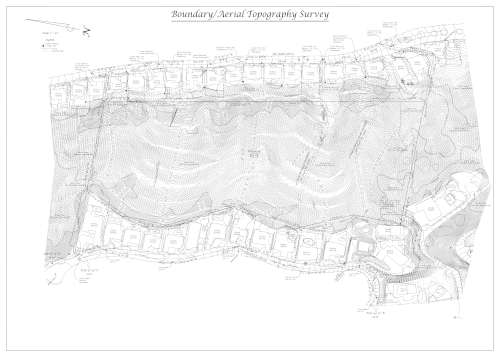
Aerial Topography Survey
Why would I need this type of survey?
Large properties or those with steep/rugged terrain may require the use of aerial photogrammetry to collect topographic and feature data.
Some areas may not have vehicle or foot access due to fencing, lack of roads/paths or neighbors’ restrictions.
Some cities and government agencies require maps to show topography and features well beyond the subject property in order to determine buildable area, environmental impact or other factors.
Services
We will provide a map including the following items throughout, and immediately surrounding, the subject property:
- Subject property lines
- Roads
- Buildings (roof footprint)
- Visible utilities
- Tree Canopies
- Contours
FAQ
When can you start?
Our proposal will include an estimated start-date for field work. This service will require an additional 2-3 weeks to gather and process the necessary data. Adverse weather such as fog or rain may impact flight schedules and cause further delays.
Is aerial topography sufficient for design?
Aerial topography is not intended for design use. An on-the-ground survey will be necessary for areas that require a greater amount of detail and accuracy. Contours in areas of dense brush will be approximate.
Will you be setting markers at the property corners?
Setting markers at the property corners or along property lines is not included but may be added for an additional fee. Refer to “Boundary Staking” for more details.
What do you need from us?
We will gather the documents necessary for conducting our survey. If you want us to plot easements you will need to provide a title report and underlying documents. If you cannot provide these documents we can order them for an additional fee.