Los Angeles Architectural Survey
Whether you’re planning a renovation, new construction, or need compliance verification, our expert team at M&M&Co. ensures precise assessments to guide your project every step of the way.
For over 30 years, we have been providing elite surveying services to Los Angeles and Ventura Counties. Contact us today for a free quote.
This site is protected by reCAPTCHA, and the Google Privacy Policy and Terms of Service apply.
Why would I need this type of survey?
- This survey will serve as the basis on which a remodel, new construction or landscaping will be designed.
- This survey will be included with your submission to the City, to get approval for your project.
- To memorialize the existing property features.
Services
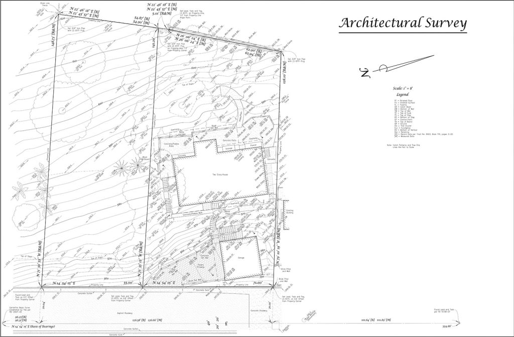
We will include dimensions from the property lines to the buildings. If access allows we will show neighboring buildings and other significant features within 5 feet of the subject property lines. We will provide a map including the following:
Subject property lines
Street-side improvements
Buildings
Fences and walls
Visible utilities
Hardscape
Trees (6” diameter and larger)
Elevations per sea level datum
Contours
FAQ
Do you need access onto the property?
This type of survey does require access to the subject property. We do not need access inside any of the buildings.
Will you be setting markers at the property corners?
Setting markers at the property corners or along property lines is not included but may be added for an additional fee. Refer to “Boundary Staking” for more details.
What do you need from us?
We will gather the documents necessary for conducting our survey. If you want us to plot easements you will need to provide a title report and underlying documents. If you cannot provide these documents we can order them for an additional fee.
What’s the difference between an architectural survey and a land survey?
An architectural survey focuses on the physical features of a building or structure, including its dimensions, layout, and existing conditions, often used for renovation or design purposes.
A land survey, on the other hand, measures and defines the boundaries and legal lines of a property, establishing property lines and easements.